See on Scoop.it – Episurveillance
The Medill Justice Project, in its now year-long effort to build a database of SBS cases, has published a portion of that data relating to the geographic occurrence of SBS. The report identifies s…
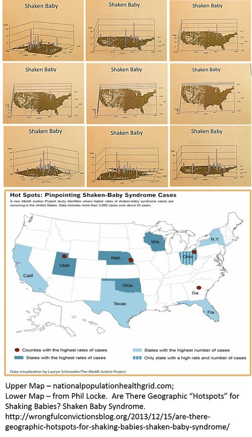
Phil Locke’s article "Are there geographic "hotspots" for shaking babies?" provides us with important insight into this growing national public health problem.
The above map in this figure is the nationalpopulationhealthgrid (NPHG) mapping technique developed for mapping any medical statistic or number down to the small area level, without the use of GIS. Beneath the NPHG map is the US map by states produced by Lauryn Schroeder of The Medill Justice Project at Northwestern University (http://www.medill.northwestern.edu/experience/bsj/exclusives/medill-justice-project.html).
NPHG allows us to identify small areas of high incidence for any medical diagnoses, episode or event. Exact locations within each of the states noted as high risk were reassessed down to the town/city level using this innovative mapping technique.
Important to note here is that NPHG displays its results in 3D, and can also be used to generate rotating videos of your results. Impressive for any public of upper level maangement presentation.
Minus the videos, NPHG can produce hundreds to thousands of maps per day, depending upon your study. The rotational 3D images used to make the videos were produced at a rate of 15,000 to 20,000 (15-20 videos) per day.
See on wrongfulconvictionsblog.org
