News in the first weeks:
“
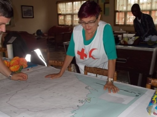
Following the second wave of the Ebola outbreak marked by a jump in the number of deaths, teams from Red Cross and MSF are currently deployed in Sierra Leone and have asked for a re-activation of HOT. GIS specialist CartONG has been deployed on the ground again and is liaising with MSF.
According to the latest report of WHO on Tuesday July 1st, the Ebola outbreak killed 467 people, with about 759 cases of hemorrhagic fever identified in the three affected countries, Sierra Leone, Guinea and Liberia. This is 129 more deaths than the previous record from a week ago, an increase of more than a third, a sign that the epidemic is spreading after a lull in April.
“
Source: hot.openstreetmap.org
Two weeks ago I reviewed the press, news, etc. for GIS and Ebola related postings. I first published the social media response at the general public level, the chats out there, the events that happened before the WHO and other major agencies reacted to this impending outbreak.
I then posted some of the popular news and popular culture impressions pertaining to Ebola, with reference to GIS, as a measure of how much the public, media and medical profession in general understood the value of GIS in monitoring these outbreaks, and why a global program needs to be implemented that monitors disease activity effectively, outside the closed quarters of Homeland Security, WHO and CDC establishments.
The following are the refereed professional articles on the value of GIS in Ebola and a number of pages detailing the importance of IT, RS and other advancements in disease surveillance. These may have been to our benefit, had they been implemented by the time this last Ebola outbreak began.
*********************************************
SATELLITE IMAGERY – PUBLIC RELATIONS
Satellite imagery is naturally a related hot topic for this field. We haven’t seen as much “new” or even articles on the use of these services. But these services no doubt exist. The following are prime examples of these pages.
afrol News, 23 December 2013 – European satellite to assist solving the Ebola enigma. http://www.afrol.com/articles/10731
Solving The Ebola Enigma: Satellites Will Provide Clues . http://www.sciencedaily.com/releases/2003/12/031223062412.htm
*******************************************
NON-REFERREED PRESS (Opinion papers, company white papers, etc.)
September 2004. Dr. James Deutsch, Director, Africa Program, Wildlife Conservation Society To intervene or not? Implications of models of ebola spread in African apes (apes and Ebola). http://www.oneworldonehealth.org/sept2004/pdfs/jamesdeutsch.pdf
GIS Support for the MSF Ebola response in Guinea in 2014. 1st Edition. Jul 2014. Operational Center, Geneva. http://cartong.org/sites/cartong/files/GIS%20Support%20for%20the%20MSF%20Ebola%20Response%20in%20Guinea_Case%20Study.pdf
A review of this is at http://reliefweb.int/report/world/gis-support-msf-ebola-response-guinea-2014-case-study
Dated July 15, 2014.
*******************************************
MOSTLY SCHOLARLY WRITINGS — ACADEMIC PAPERS (Term papers, Thesis, dissertation)
[COURSE DESCRIPTION/ESSAY] Role of GIS in Tracking and Controlling Spread of Diseases. Final Draft. By Syed Imran Quadri , ID # 220560 , For CRP 514: Introduction to GIS , Term 041 – 11th Offer. Course Instructor: Dr. Baqer Al-Ramadan . Date: 12, 19, 2004.
*****************************************
ACADEMIA
[INTERESTING STUDENT’S TERMPAPER] http://faculty.kfupm.edu.sa/crp/bramadan/crp514/Termpapers/Term041/7%20-%20Term041%20-%20Report%20-%20Imran%20Quadri.pdf
[TERMPAPER? THESIS?] Anumba Joseph Uche. Scientific Officer,national Arbovirus and Vectors Research Centre, Enugu-Nigeria, Integrating GIS and Remote Sensing Technology In Contact Tracing Of Ebola Virus Disease Cases In Nigeria. Downloadable from academia.edu.
[THESIS] Rahel Dubiwak Gemmeda (2012). EMERGING INFECTIOUS DISEASES WITH LIMITED TREATMENT OPTIONS: THE CASE OF EBOLA HEMORRHAGIC FEVER IN UGANDA AND SHIGA TOXIN PRODUCING ESCHERICHIA COLI IN THE UNITED STATES .
A Paper Submitted to the Graduate Faculty of the North Dakota State University of Agriculture and Applied Science . By Rahel Dubiwak Gemmeda In Partial Fulfilment for the Degree of MASTER OF SCIENCE. Major Program: International Infectious Disease Management and Biosecurity , August 2012 Fargo, North Dakota.
[DISSERTATION] Gerardo Chowell-Puente. (2005). MATHEMATICAL MODELS OF EMERGENT AND RE-EMERGENT INFECTIOUS DISEASES: ASSESSING THE EFFECTS OF PUBLIC HEALTH INTERVENTIONS ON DISEASE SPREAD. A Dissertation Presented to the Faculty of the Graduate School of Cornell University in Partial Fulfillment of the Requirements for the Degree of Doctor of Philosophy. January 2005. Accessed at http://math.lanl.gov/~gchowell/publications/GCHOWELL.pdf
*************************************************
ARTICLES
Jessica Hughes. 2010. GIS-Based Interoperability System Alters How Virginia Manages Emergencies. An information-sharing system provides the state with a common operating picture during disasters while aiding a national pilot to capitalize on the power of GIS data. October 25, 2010. Emergency Management. http://www.emergencymgmt.com/disaster/Virginia-Interoperability-Picture-Emergency-Response.html
Tambo, E., Emmanuel Chidiebere Ugwu and Jeane Yonkeu Ngogang (2014). Need of surveillance response systems to combat Ebola outbreaks and other emerging infectious diseases in African countries. Infectious Diseases of Poverty. 3:29.
http://www.idpjournal.com/content/pdf/2049-9957-3-29.pdf
Peterson AT, Bauer JT, Mills JN. Ecologic and geographic distribution of filovirus disease. Emerg Infect Dis [serial online] 2004 Jan [date cited]. DOI: 10.3201/eid1001.030125 Available from: URL: http://wwwnc.cdc.gov/eid/article/10/1/03-0125
************************************
BOOKS
(I know that over the last two decades, many more pop culture books are out there discussing the past present and future of global health and disease outbreaks; they are not mentioned here.)
George Korte. The GIS Book. http://books.google.com/books?id=_C6oPvJ5S_EC&pg=PA15
See on Scoop.it – Medical GIS Guide
