SEATTLE (AP) — A 16-year-old boy who fired two gunshots Monday inside a Washington state high school, hitting no one before a teacher tackled him, told detectives he never intended to hurt any students, a police spokesman said.
Source: news.yahoo.com
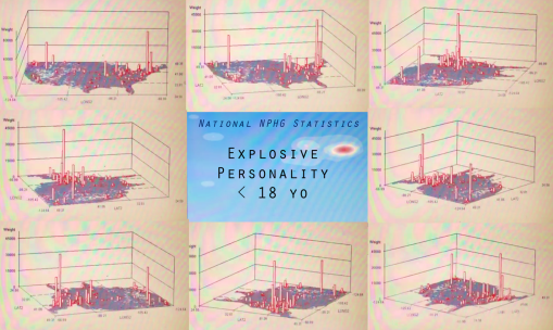
What are the spatial determinants for this? Population density? Rural versus urban? Pop culture in the school setting? Large schools versus small schools? Socioeconomic Status? Levels of Education? Social and cultural labels? Race-ethnicity patterns?
EMR/EHR should be capturing this data right now. This means that in a year or two, maps like those on display can be produced using your HIT system. The priorities to accomplishing this goal (in descending order) should be: data completeness, SQL, skillsets, SAS or equivalent (non-GIS), long term storage capacity, virtual space for rapid data description, analyses and reporting.
The above dataset took just 7-15 minutes to pull and generate 750-1000 maps with, and another hour to produce the video. For reporting purposes of course, there is no need to make the video. No GIS was required. Only the most basic, most standard systems HIT tools.
See on Scoop.it – Episurveillance
