The year-long rise of ISIS, and its leaders’ appeals for supporters to carry out attacks around the world, has authorities on high alert.
Sourced through Scoop.it from: www.nbcnews.com
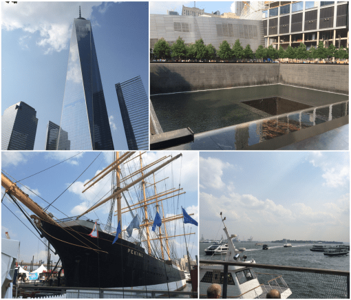
Visiting New York City yesterday, it was clear that the southern tip of Manhattan is now the center of homeland security surveillance.
New York City should be the center of surveillance for any spatial epidemiology program.
The very first disease map we have on paper was produced in the late 1790s by Dr. Valentine Seaman of the medical school in New York.
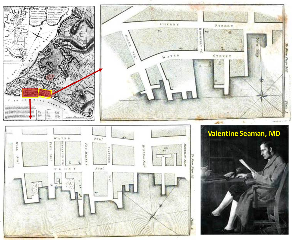
He was trying to determine if yellow fever was of local origin or imported by ships (our famous Benjamin Rush blamed it on imported coffee beans that went sour).

A number of past yellow fever outbreaks made their way into this country via these slips and piers. More would follow, for example malaria, cholera, diphtheria, typhoid, and most recently west nile and measles (Palisades Shopping Plaza, 2013).

The rates at which people move in and out of this location are unimaginable. The other day, at about 2:30 in the afternoon, in just fifteen minutes I saw more than a hundred ferries and tourist boats, helicopters, subways, air, land and water taxis, city and tourist buses, and private tourism vehicles.

Three hours later, as I took leave from this area, I could see they were dropping off more than a thousand locals and tourists per quarter hour, right around dinnertime.
This meant that the routes leading from South Street Seaport to the 911 Memorial Museum were filled with thrice as many people than typically seen at this time of the day. You couldn’t help but follow them.

The travel routes were well defined by roadblocks. These well-defined routes to the Memorial were secured by nearly a dozen different types of public service, military, guard, national park, and homeland security units. Need I say, surveillance cameras were everywhere, and as this new story indicates–they were even way overhead in the form or aerial and satellite surveillance. The subway I was heading to was in this general direction. All I had to do was follow the masses, then take leave once I reached the tunnels.
When I got close to the entrance to the subway station, enough people were heading underground to fill the stairways. I decided to hold off a half hour, and so headed to where everyone else was flocking, the 911 Memorial. You could see hints of this setting two blocks away. There was a new rib-like display in place, mimicking the skeleton of a fish or fallen building, I thought.

Now, imagine having to trace the source and predict the path of a biological outbreak that originated here in upcoming days. That is what a Biosecurity Unit can do using GIS.
See on Scoop.it – Medical GIS Guide
