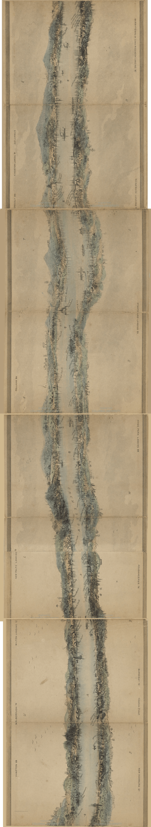
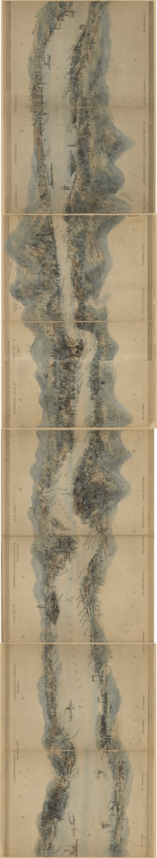
The following is a merging of the images from an 1847 book on the Hudson Valley.
The Catalogue record of this book, made available by Columbia University, is as follows (from https://catalog.hathitrust.org/Record/100856041):
Wade & Croome’s panorama of the Hudson River from New York to Waterford [electronic resource], drawn from nature & engraved by William Wade.
| Main Author: | Wade, William, active 1844-1852. |
|---|---|
| Related Names: | Croome, William, 1790-1860., Disturnell, John, 1801-1877. |
| Language(s): | English |
| Published: | New York, J. Disturnell, 1847. |
| Subjects: | Hudson River (N.Y. and N.J.) > Aerial views. Aerial views. |
| Note: | Accompanied by 1 booklet, 1847. 38 p. Includes notes. “Plate printed by Burton.” Shows points of interest and miles from New York City. Relief shown by spot heights. |
| Physical Description: | view 414 x 15 cm. folded to 11 x 15 cm. + 1 booklet. |
| Locate a Print Version: | Find in a library |
This book is accessible at https://babel.hathitrust.org/cgi/pt?id=nnc2.ark:/13960/t1tf34g6z;view=1up;seq=1
These maps are depicted in the original book as 19 electronic pages, apparently merged by the staff at Columbia who produced the images of each page or two page spread.
Each of the following five images version was produced by merging four of these consecutive maps together at a time.