
There is this cemetery on Osborn Hill road that I always passed on the way to Fishkill Village from home, or travelling to school by school bus back when I was very young and attended Fishkill Elementary, and again when I went to John Jay High School.
I’ve been trying to remember if back then there were just as few gravestones visible from the street as there are today. I believe there may have been just a handful more, perhaps 2 to 5, including the large stone cross that stood in the back.
For most of those years, the cemetery has been kept up, with its grass being cut and the saplings taking root kept to a minimum.
When I was very young, I know I asked my mother about this cemetery several times, as well as about the one next to it, across the road, due to the numerous headstones standing in that cemetery, many with stones sitting on them. My mother told me the latter grave year, which was also well fenced and protected, was an active Jewish cemetery, and used that to explain the stones. We’d also often talk about the other one just across the road, which she called a “negro cemetery.”
I was under the impression most of my life that this cemetery was a town cemetery–the kind that the people and later just local town officials kept up–most as a service to poor families that couldn’t afford their own plots. The lack of homogeneity of the stonework didn’t ring any bells with me about the cemetery actually being linked to a church at one time. In decades to come, I had the chance to see some of the cemeteries that towns produced and managed, with similar stones standing across the plots. Because this cemetery had in fact very few stones visible from the road, it never occurred to me that they were there, but just invisible because they had been knocked down, broken over the decades, as a result of typical vandalism habits engaged in by the local teenagers and young adults.
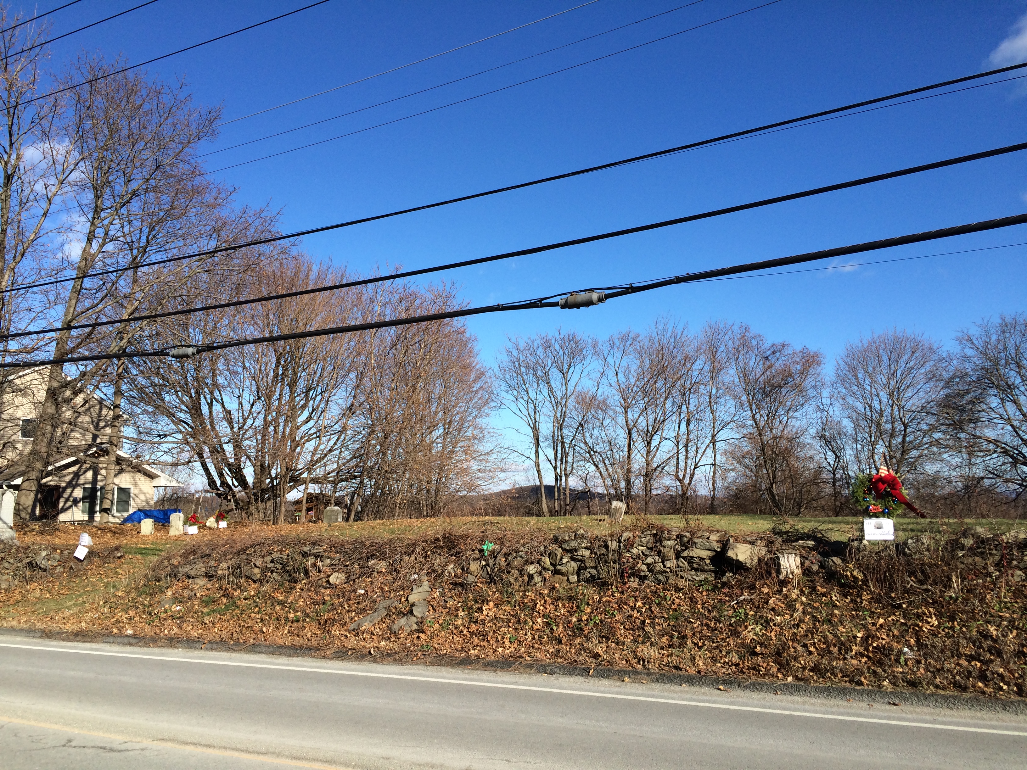
One of the main reasons this cemetery is rarely visited, is that it is hard to visit. There is no place to park if you wanted to stop by there, except a precariously placed pull over spot about 35-40 feet from it, towards Fishkill Village, with the mile marker to New York City sitting there beneath the Juniper Tree. The last thing I wanted to see happen was destruction of that milestone, which to me was more a sign that I had made it to the peak of the summit of this road, when I used it to walk home from Barker’s or the carnival often set up there; heading south, it symbolized my last descent back into the village of Fishkill, when the desire was to go there to visit someone or some thing.
In 1976 I left the Hudson Valley region for a number of years, never thinking much about this place. When I came back to New York, from Oregon, for working on West Nile outbreaks in 2002, I remembered this cemetery frequently each time I did my daily 200-250 mile travel about the county, monitoring its various places for mosquito populations.
Strangely, whenever I passed that cemetery I always remembered what my mother had called it–a “negro cemetery”, which I though was there to attend to the poor. Yet, it hadn’t barely been used in all these years, leading me to wonder why.
Again, I moved out of the region, this time to Colorado. Lived there another 6 or 7 years. In 2010 I came back to the region, and stayed at a high school friend’s family home at the top of Osborn Hill. This meant that everyday I had to drive to work down near New Jersey, I would again have to pass by that cemetery plot each and every time. Once again, I had those same questions on my mind about this place.
Moving about the county several times from 2010 to 2013, I never had the chance to explore this spot, to figure out what it is. Finally, in 2014, that opportunity came, just before Labor Day in September. The July 4th before I had visited the more accessible inactive cemetery on old route 9 at the corner of Middlebush Road. This was also a “negro plot” I deduced, and it had just a few stones standing for me to check out.
That plot also consisted mostly of open space, meaning either it wasn’t fully used, or had lost most of its relics. The stones along its edges were the only ones standing. They were soldier’s stones. Being next to the Cable TV place, stopping there was convenient, and the roadside had ample parking area. So after paying the bills, picking up or dropping off old equipment for the TV, I’d walk about that site for a half hour or so.
So I guess these are the memories I had that I forgot about, until I stopped at the Osborn Hill cemetery, to make similar observations, since what was left to learn about that place.
Both the Middlebush Road and Osborn Hill Road cemetery display the results of early 20th century vandalism, performed at a time was racism was reaching a new peak.
Interestingly, if you look at the late 19th century people buried there, their personal and family histories, their occupations as noted in the census reports you could uncover, you’d see that the white-black racism problem did not exist to the extent that it did when you were a child, living the 50s, 60s and 70s. The people buried in these plots in the late 1800s were community servants of various forms. One of the names I looked up was of a carriage man, whose role was to bring those that paid him around the town, from one office to the next, one important local event to the next. He had moved out of the marshlands where his family raised a farm on in the Town of Baxter, to live adjacent to the stall where horses were kept down by Fishkill Village, somewhere close to the end of Jackson Street.. Whether or not his work involved the building that is still standing in this part of town is uncertain.
So what happened in the early 1900s that caused these community practices to cease happening?
The differences in types of jobs blacks versus white had was becoming more apparent. Racially related income differences were forming. To some African American generations, this must have been reminiscent of the attitudes that evolved about slavery in the mid 19th century.
One of the most unique things about the town of Fishkill in all of this history was the important role it played in freeing the slaves–the process of manumission–starting as early as 1802/4. Evidence for this early moral decision made about slavery and blacks appears in some of the books published by genealogists, documenting these manumission agreements or certifications. One of the first of these certifications I ever came upon was that for Samuel Loudon, who owned a printing press, printed the New York State currency and new State Constitution during the Revolutionary War, and who was a newspaper publisher throughout all of those years, which amounted to about 1776 to 1783/5.
Samuel Loudon was one of the first to write and sign a certification for manumission for his slave or servant, sometime around 1802/4. He was not the only one to do this for the region. As far north as Pine Plains, there were black workers being freed so they could own their own land, start up their own farms, just north of the Village. While residing at their new place, they still served as servants to the local fruit growers, mostly apple orchard owners.
This same movement was happening in the Fishkill area as well about this time. Sometime in the early 1800s, perhaps around 1810, a Scotsman living in the region took heart for the manumission movement and purchased and then handed over a large lot of land between Fishkill and the Stonykill region. His name was Baxter, and thus the area he purchased and handed over to the freed African Americans became known as Baxtertown. It was on this property that families moving there built their church.
[photo from 1863 map]
Trying to understand why the cemetery for this community was so far away, and in particular not heavily developed on the original church grounds for Baxtertown, one has to realize the concerns people had then about burying deceased relatives. The yellow fever years seemed as though they were in full swing to some. We hadn’t a clue as to the cause for this epidemic, which was mosquitoes, but knew that certain environmental settings were prone to making this disease happen. One major philosophy about the fever was that its cause resided in the body, and could be passed from one person to the next via the air, in a way akin to the 18th century concept of miasma, believed in so heavily within this region. The miasma theory had undergone several changes around this time, and although its basic mechanisms of passage and spread were the same, some of the terminology used to describe it had changed over time. Effluvium was a common term used to define the emanating gases or fumes though to spread disease from a decayed, deceased human body. For this reason, the placement of the cemetery upon atop Osborn Hill was in fact a very healthy choice. The air that flowed across this setting was often intense; it could travel in any direction. There was no better way to clear out the contagion that sat in this place due to the burials made there.
At the time many of these decisions were being made, the doctors of the area immediately surrounding this cemetery were also probably involved in this decision making process. Two such physicians owned or were direct neighbors of the owners of the land used to produce this cemetery–James Osborn and his younger brother of two, Thomas, was involved in this decision making perhaps, along with the famous Bartow White, living at the bottom of the hill in where Barker’s mall was built and practicing in the building now owned by Auchmoody, and the Van Voorhis family, one former patron of which was Isaac, a physician who began his career as a military surgeon and who was killed in the Chicago massacre just a couple of years earlier. Either Van Voorhis or his immediate neighbor provided the freed African Americans with this healthier land, upon which a cemetery could be “safely” built.
We can deduce the earliest year(s) this cemetery was put to use by the death dates on its headstones. To date, the earliest such date is about 18___.
The pages attached to this head page are of the history of this cemetery, its church, culture and families, and of the people whose headstones are found on this plot.
When I first visited this plot and went through its few remaining headstones that were visible, legible, in detail, it became immediately obvious that this location has an important history.
The third or fourth headstone I found that was worth reviewing was the one leaning against the stone wall at the front of this property. It had on it “Yellow Bluffs, Fa.” Having not read anything about this place before, this led me to check the internet and mapping device for a place called “Yellow Bluffs”; I got two or three places. I then decided that the “Fa”, which I could clearly see was “Fa” and not “Va”, referred to Florida. When I entered that into the search box, what I found was completely unexpected–a page for the Yellow Bluffs National Parks site, where a famous series of battles were fought, the Union against the Confederates, with the Union trying to maintain possession of the sand bluffs. This soldier fought in that battle, along with just 6 or 7 others, and three days later died due to the injury he sustained. From that point on, researching and dealing with this forgotten part of our local history became one of my primary goals.
As many have now noticed, I next went down to the Fishkill Village florist that afternoon and placed an order for the wreathes I planned to put up, one month later when holiday wreaths were being posted for other military grave sites all around the country. I then went back up to the site and began my documentation process. Later that night, I contacted Willa Skinner about this finding.
